Emergency Management Map
A map showing crucial emergency management information, include communication towers and signal type, ESN service areas, road networks and address…
Pocahontas County Tax Maps
Pocahontas County, WV Tax Maps, where users can view tax assessment data, print maps, and take measurements.
The WV Digital Divide Index
I used the Digital Divide Index methodology, originally created by Purdue University's Center for Regional Development, to analyze the digital…
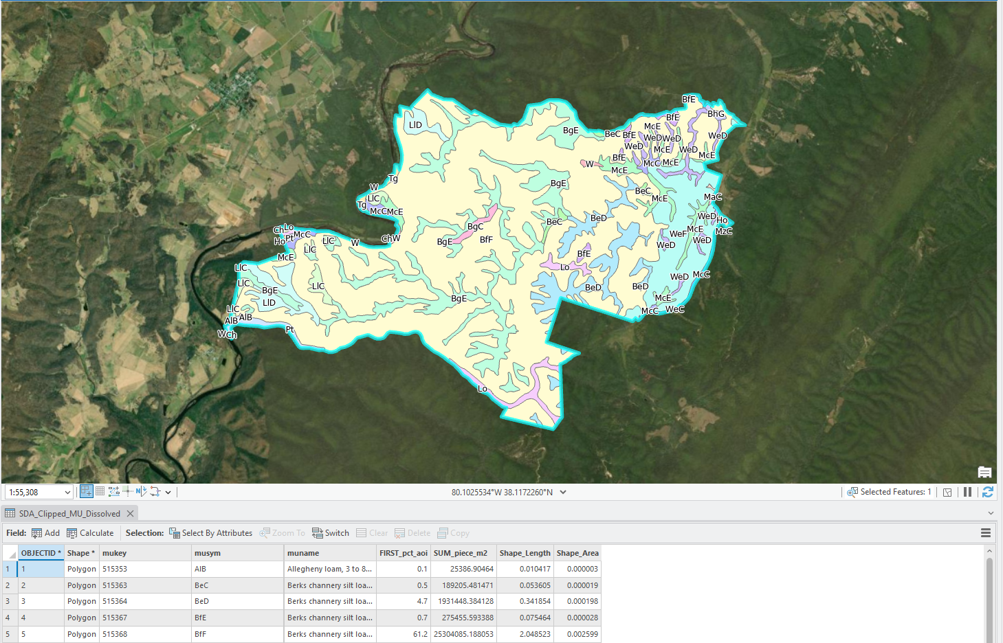
Querying NRCS Soils on the Fly
I created a Python Toolbox for ArcGIS Pro that queries the USDA NRCS Soil Data Access API directly from ArcGIS…
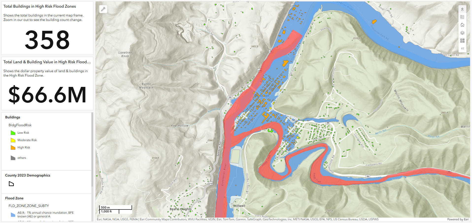
Property Values within Flood Zones
An interactive dashboard that displays flood zones and property values in Pocahontas County, WV.
Nashville Transit Map
An interactive map of the Nashville, TN transit system build entirely in HTML using Leaflet.
Pocahontas County Voting Precinct Map
A map showing voting districts, polling locations and address points to help voters determine which district they reside in and…
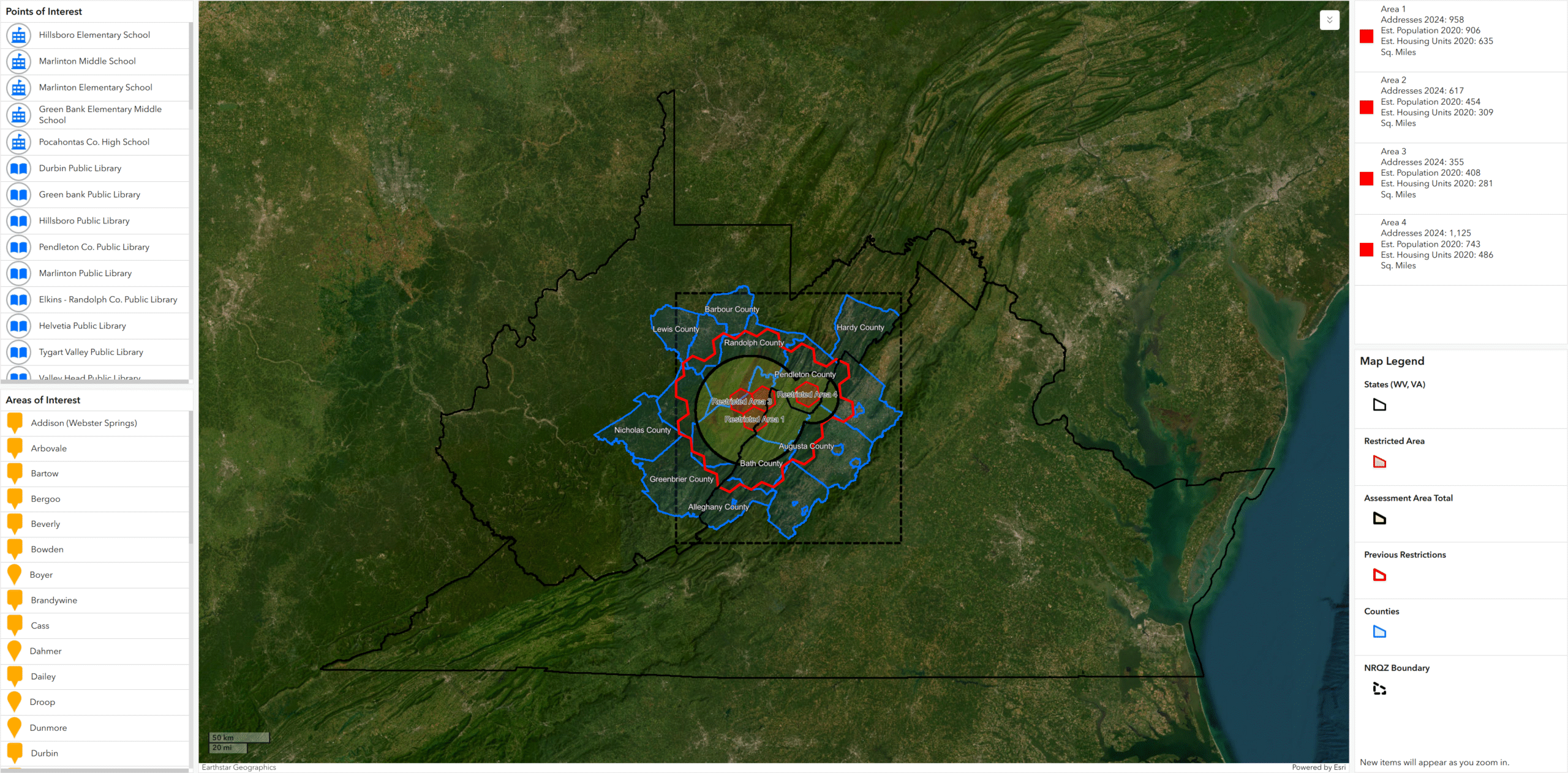
Mapping Digital Exclusion in the NRQZ
I developed an interactive ArcGIS Online dashboard to assess the population and critical facilities impacted by Starlink service restrictions within…
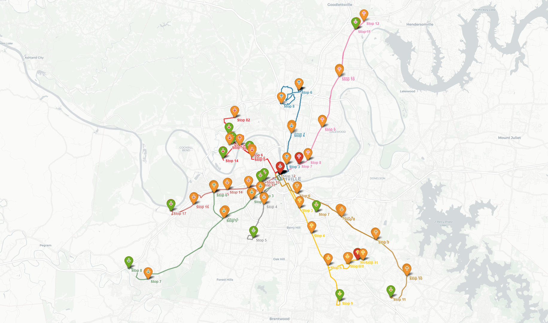
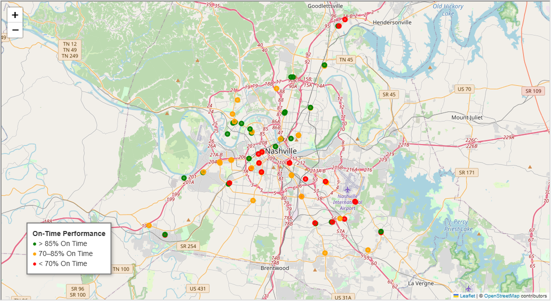
Nashville Public Transit Analysis
This geospatial analysis visualizes the on-time performance of Nashville's bus network using GPS-based data from WeGo Public Transit. Each stop…